Precision Aerial Data, Tailored to Your Needs

Your solution to every problem

DroneHive combines advanced drone technology with industry expertise to deliver end-to-end aerial services that help businesses and homeowners across Cornwall, Devon, Dorset, Somerset, Wiltshire, Bristol, Hampshire, Berkshire, and Surrey make data-driven decisions. Our lean, client-focused approach means you always get tailored flight plans, transparent timelines, and the highest quality deliverables—keeping projects on schedule and budgets under control.

  • Infrastructure Planning – Site Map Overlays

  • Volumetric’s – Advanced Measurements

  • Land Surveying – Covering areas of any size

  • Slope Measurements – Photogrammetry for accurate results

  • Thermography – Thermal Imaging with many applications

Your Mission – Our Swarm

Reach new heights with strategic drone missions

From the initial flight plan through to final report delivery, our expert pilots use cutting-edge drones to capture the insights you need!

Construction Site Survey

Capture high-resolution orthomosaic maps and volumetric analyses of earthworks, stockpiles, and site progress—updated on your schedule for precise progress tracking and resource management.

Map Your Site From Every Angle

Solar Panel Thermography

Keep your solar investment performing at its best. Our drone-based thermal scans quickly pinpoint faulty cells, hotspot issues, and wiring faults—no ladders or scaffolding required.

Maximize Return from your Solar Investment

Roof & Building Inspections

Leverage thermal imaging and zoom-capable optical sensors to detect leaks and insulation issues—delivering annotated high-res maps, heat-maps, and detailed defect reports.

See your house from a New Perspective

Real Estate Visuals & Media

Showcase properties with cinematic 4K aerial imaging footage, interactive 3D models, and true-scale floor-plan overlays—capturing buyer attention and elevating your marketing collateral.

Stand Out From The Competition

Solar Farm Thermography

Utilize advanced thermal imaging technology to pinpoint underperforming panels, soiling zones, and wiring faults—providing you with geo-referenced fault maps, efficiency charts, and maintenance recommendations.

Cutting Edge Radiometric Technology

Crop Health Monitoring & NDVI Mapping

Use multispectral and NDVI sensors to assess plant vigor, irrigation needs, and early pest or disease stress—delivering field-wide health maps, zone-specific treatment plans, and yield-optimization insights.

Minimize Crop Losses

Our Advanced Aerial Equipment

Drone Surveying Point Cloud Technology

Point Cloud

Drones capture millions of 3D points to create detailed digital maps of terrain and structures. This precise model lets you measure distances, elevations, and features with confidence—perfect for complex site analysis.
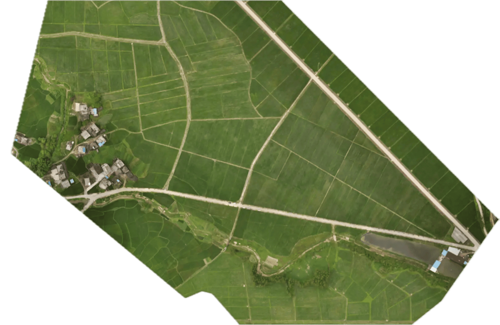
Photogrammetric Data and how it works for aerial surveying

Photogrammetry

By stitching together overlapping drone photos, photogrammetry generates accurate 2D maps and 3D models. It’s faster and more cost-effective than traditional surveys, giving you high-resolution visuals for planning and progress tracking.
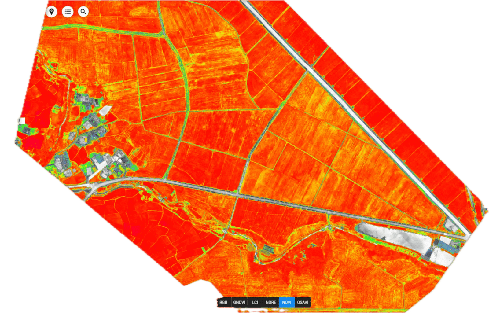
Agricultural Survey Clear Farm Drone Service

NDVI Mapping

Multispectral sensors record light beyond what our eyes see, highlighting issues like crop stress or water shortages. Early detection through these spectral maps means smarter decision-making and resource savings.

Solar Farm Thermography Aerial Drone Inspection

Thermography

Infrared cameras on drones reveal heat patterns you can’t see, spotting electrical hotspots, insulation leaks, or moisture under roofs. Quick, safe scans over large areas help you catch problems before they become costly repairs.

Construction Site Survey Aerial Survey Orthomosaic map

Orthomosaic

Orthomosaics blend dozens of drone images into one distortion-free, true-to-scale map. You get a seamless, high-resolution overview of your site—ideal for accurate measurements and change monitoring.

LiDAR Data of Aerial Survey of Bridge Infrastructure

LiDAR Data

Laser pulses from a drone produce ultra-precise 3D terrain models, even under vegetation cover. These dense point clouds uncover hidden features and obstructions, giving you an exceptionally detailed view for engineering or environmental work.

Client Centric System to maximize value

Our HiveLink Approach

The HiveLink Platform allows you to remain a part of every step of your mission from start to finish. Every solution from Aerial Imaging to Solar Farm Thermography, we got you covered and will guarantee a smooth and tailored process each time.

Launch your Mission

You begin by specifying your mission requirements (location, asset type, inspection objectives).

We automatically create your HiveLink account and send you login details so you can monitor mission specs and chat with our team from the get-go.

Man booking solution on laptop
Setting up a flight plan around skyscraper in Flight Hub 2

We personalized the Mission Parameters

Our operations team builds a custom flight plan, secures any necessary permits, and verifies weather conditions.

Certified pilots then calibrate the drone and sensors, logging every safety and compliance step.

We Deploy

On mission day, we arrive on‑site, finalize setup, and perform a final weather check.

The drone flies the planned route while sending live telemetry to HiveLink, and all raw imagery and sensor data are safely offloaded when the flight ends.

Matrice 350 RTK Ready to Deploy over field for Crop Health monitoring
DJI Terra Reconstruction

Data Processing

Back at our processing center, automated workflows transform your data into orthomosaic maps, 3D models, and other deliverables.

Our engineers verify each output’s accuracy, then upload preliminary results to HiveLink so you can preview findings right away.

Results At your fingertips

We compile a comprehensive report—complete with annotated images, maps or models, measurements, and actionable recommendations—and make all deliverables available in your HiveLink dashboard.

You’ll receive a notification when everything is ready, and our team stays on hand for any follow-up questions.

Person Working 1